
|
|
|
|
|
|
|
|
|
|
|
|
|
|
|
|
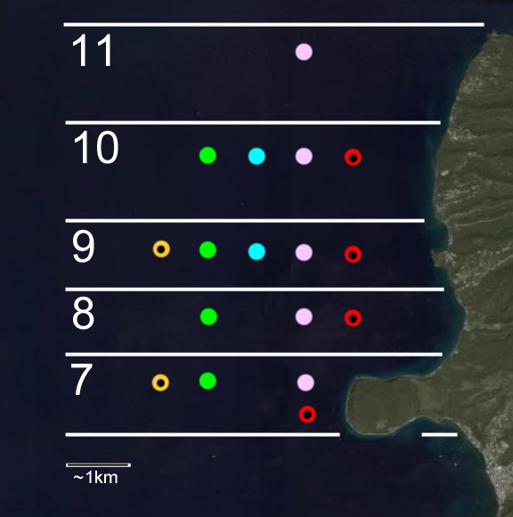
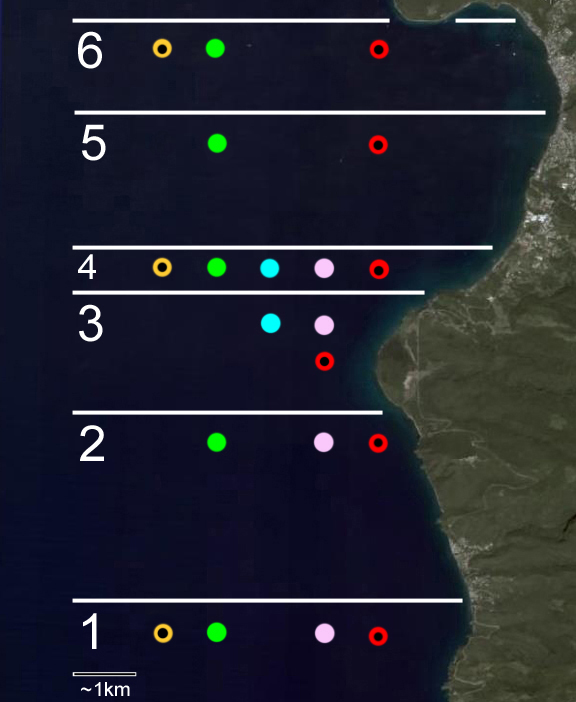
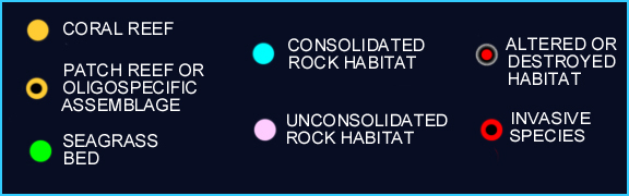
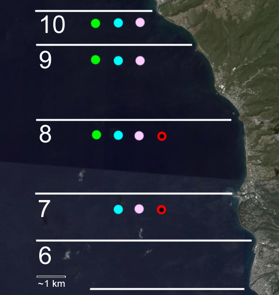
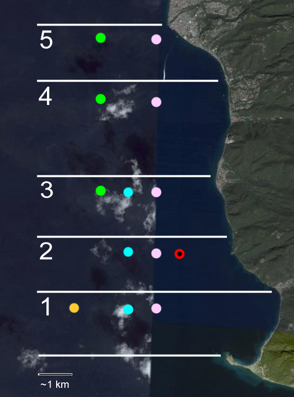
The southern shore of the Cabrits harbors remnants of patch reefs that were probably mined during the construction of Fort Shirley. The patch reefs along the northern end of the Cabrits also show signs of sever physical destruction. Within the swampy area east of Cabrits, white mangroves can be found. A fairly solid band of seagrasses starts on the southern end of Douglas Bay and continues all the way to Anse Bell. In that stretch coral assemblages on rocks in Douglas Bay (N), the patch reefs of Toucari Bay (s) and the coral assemblages on large consolidated rock formations near the Hermitage River can also be found. For each of the following areas /sites, colored dots (see key below map) mark the presence of specific habitats baring sessile epibenthic communities. The areas/sites are: 1. Pointe Crabier to Bioche; 2. Bioche to Espagnol River; 3. Espagnol River to Ti Bai; 4. Ti Bai to Lamoins River; 5. Lamoins River to Indian River; 6. Indian River to Swamp Ravine (work in progress); 7. the Cabrits or Swamp Ravine to Bell Hall River; 8. Bell Hall River to Manicu River (Tanetane); 9. Manicu River to Toucari Bay (N); 10. Toucari Bay to Anse Bell; 11. Anse Bell to Capucin. |
|
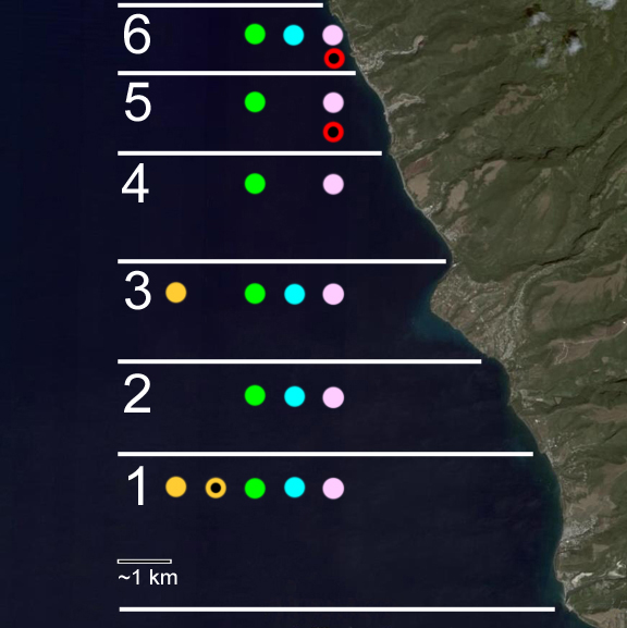
A combination of factors lead to this diversity. On the southern end, the largest river of Dominica (Layou) opens into the sea. It brings sediment to build the shelf and contributes to ample spaces for seagrass beds. In the area around Mero sandy bays and rocky deposits offer the right conditions for sea grasses and coral reefs. The shelf surrounding the Grande Savane area is the widest along the west coast that is also well flushed by ocean currents. Shallow illuminated waters provide ideal conditions for coral reef development and growth. The areas north of Grand Savane are in the rain-shadow of Morne Diablotin. This drier region has fewer rivers that flow year round and so despite the narrow shelf, sea grasses and coral communities thrive where settlements and quarries are not close by. For
each of the following areas, colored dots mark the presence of specific
habitats baring sessile epibenthic communities. |
|
North of Roseau the shelf widens slightly and broadens the spectrum of habitat types. In Fond Cole a variety of coral habitats are established on consolidated and unconsolidated rocks. This area also includes some of the oldest corals of Dominica estimated to be over 500 years old. Seagrasses are well developed all the way to Layou. To date, the Canefield cliffs are the southernmost distribution point identified for the invasive Halophila stipulaceae. For
each of the following areas, colored dots (see key below map) mark
the presence of specific habitats baring sessile epibenthic communities. |
|
INDEX | INTRODUCTION |REGIONS | HABITATS | SPECIES | STATUS | CONTRIBUTORS | REPORTS
Institute
for Tropical Marine Ecology ITME Inc., P.O. Box
36, Roseau, Commonwealth of Dominica.
ITME
is a not-for-profit institution for environmental education and research.