
|
|
|
|
|
|
|
|
|
|
|
|
|
|
|
|
|
. |
1)
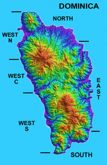
North: From Capucin to Melville Hall River The
delineation is base one a combination of (a) geographic features
easily identified when traveling around the island, and (b) the
number of sites described here. By selecting (clicking) a particular region (NORTH, EAST, SOUTH, WEST S, WEST C or WEST N) you can access a general description of which habitats (icl. distribution maps) are found in the region chosen. Additional habitats distribution maps can be accesses via "supplemental document" at www.itme.org/data.htm |
|
|
|
||
|
Image adapted from original radar topography map by Dr. Ian C.F. Stewart |
||
INDEX | INTRODUCTION |REGIONS | HABITATS | SPECIES | STATUS | CONTRIBUTORS | REPORTS
Institute
for Tropical Marine Ecology ITME Inc., P.O. Box
36, Roseau, Commonwealth of Dominica.
ITME
is a not-for-profit institution for environmental education and research.